historical geography historical places
One Place, Five Authorities
A name can survive a border change, a conquest and a map revision while the thing it denotes changes. Historical geography makes the mapping explicit; a time series should do the same before it compares locations across years.
- You are seeing
-
- A regional revenue series jumps when a sales territory is renamed
- A geocoded customer history is joined to a current map without an effective date
- Two reports use the same country label but include different border regimes
- A historical place name is treated as proof of a single boundary, controlling power or founding date
- The mechanism
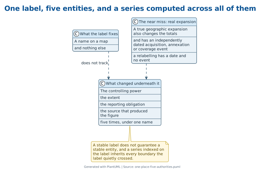
- Historical geography tracks changing political entities behind a map label, while historical-place records separate a place's name, extent, controlling power and evidence source; the contact is that a stable label does not guarantee a stable referent.
- The older apparatus
- Historical geography imposed dated border sequences and source-qualified maps, preventing a present label from being projected backward without a transition record.
- The false friend
- A true geographic expansion also changes totals, but it has an independently dated acquisition, annexation or coverage event rather than only a relabelling.
- The discriminating test
- Hold the name constant and compare the polygons, controlling powers or inclusion rules on both dates; a changed referent makes the apparent time series a collision.
- On your own data
- Version every geographic key with effective-from and effective-to dates, then rerun each cross-period comparison on the intersection of the two historical footprints.
Constantine refounded the city on 11 May 330 AD. That date exists because the refoundation was an imperial act performed in front of contemporary observers who wrote it down.
The city’s traditional founding, around 657 BC, rests on later Greek tradition. Both dates are in the record and neither is wrong.
They are answers to different questions, obtained by different means, and a table with one column headed founded will hold exactly one of them without saying which.
After that the site keeps its position and changes almost everything else. Roman, then Byzantine, then Latin Crusader rule from 1204 to 1261, then Ottoman, then the Republic of Turkey after the capital moved to Ankara in 1923.
One place. Five authorities.
Three names, and not one of them is an identifier for the others.
What a place record keeps in separate columns #
The fields are not difficult to write down. They just do not fall out of the label, which is why the label gets used instead. A founding date needs its method attached. Constantine’s has a ceremony and witnesses. Byzantium’s is tradition recorded centuries after the fact. Angkor’s declaration of universal kingship in 802 AD survives in Khmer inscriptions. Those are three evidentiary bases wearing one column heading, and only the third would be described the same way by an epigrapher and a database.
Extent is worse, because it produces a number and numbers travel further than the caveats behind them. Angkor’s UNESCO-inscribed zone covers just over 400 square kilometres. That figure comes from a heritage nomination survey conducted in the twentieth century. It is not, and was never meant to be, a measurement of the ancient Khmer state.
The Silk Road shows the same split in a way nobody can miss. The inscribed Chang’an–Tianshan corridor runs roughly five thousand kilometres. The full historical overland network is usually given as something over six thousand.
The first is a modern management subset. The second is a historical object. Neither is a correction of the other, and averaging them would produce a number describing nothing at all.
A map is evidence, not a picture #
Old maps get dated the way any other artifact does, and the construction is part of the proof rather than a detail about it.
The surviving fragment of Piri Reis’s 1513 map carries a legend saying its maker drew on some twenty prior charts and eight geographic treatises, including a Columbus map of the West Indies that has not survived. Its coastline data, its projection choices and its place-name conventions are checked against the sources and techniques a compiler working in 1513 would have had.
The signature is not the whole proof.
What the map was made out of is.
This is the discipline a modern geographic field lacks entirely. A map is not a neutral picture of a place. It is evidence of a particular boundary, drawn by a particular authority, for a particular date, and every one of those three facts can be missing from the file while the shape renders perfectly.
Some places cannot supply the field at all #
There is a limit here, and it is worth stating rather than working around.
A historical place may simply have no boundary to recover. The Hanging Gardens have three live positions: a literary invention, a real Babylonian structure since destroyed, or Stephanie Dalley’s relocation of them to Nineveh under Sennacherib. No Babylonian text mentions the gardens. No excavation has found them at Babylon. There is no area figure for either candidate site, and there will not be one.
The Silk Road has no founding power and no controlling-power count, because it crossed the territories of dozens of contemporaneous states and belonged to none of them.
A blank field in those records is not a lapse in research.
It is a description of the object.
Where the transfer runs the other way #
This is the point at which the historical case stops being the harder one.
A reporting system is not stuck. It can choose a polygon, a customer-assignment rule or an inclusion list before the period closes rather than after. It can store effective-from and effective-to dates alongside the choice. The choice may be entirely contestable, and it is still inspectable in a way that a vanished structure’s footprint can never be.
So the working record is a versioned geographic key: label, polygon or assignment rule, controlling entity where that matters, effective-from, effective-to, and source. The current region name is kept as an alias, because people will search for it. It cannot do the work of those fields.
A comparison across periods then runs on the intersection of the two footprints, and the remainder is reported separately as a boundary transition with the date and the rule that produced it. A real expansion has an acquisition, an annexation or a coverage event to point at. A collision has only the comfortable continuity of the name.
Byzantium, Constantinople and Istanbul are three names for one site, and the site is the only part that stayed where it was.
A region code is one name for whatever the current inclusion rule happens to cover, and the rule is not printed on the code.
The name is what makes a series look continuous. The effective-from date is what makes it true, and it is the field nobody asks for until the comparison has already been run.
Questions
How can a country name stay the same while the series changes?
A country name can denote different political footprints at different dates. Germany's German Confederation held 39 states from 1815 to 1866; the North German Confederation formed in 1866; and the German Empire proclaimed on 18 January 1871 comprised 25 member states. A series labelled Germany across those dates combines different entities unless its inclusion rule records the transition.
What shows that a regional jump is real rather than a boundary change?
The test holds the label constant and compares the covered polygon, customer-assignment rule, controlling power, or inclusion list on both dates. Italy was proclaimed on 17 March 1861 without Venice or Rome, gained Venice in 1866, and captured Rome in 1870. A total changing at one of those documented events can reflect a changed footprint; a relabelling without one is a collision warning.
Can an old customer history be joined to today's map?
Only after the historical assignment is dated and translated through an explicit boundary record. In the Burkina Faso/Mali frontier case, submitted to the International Court of Justice in October 1983 and decided on 22 December 1986, French colonial administrative texts, maps, and colonial effectivités supplied the relevant boundary evidence. A present map is a later construction, not evidence that it represents the earlier territory.
Why does a historical place sometimes have no single boundary to version?
Some labels denote networks or disputed sites rather than a bounded property. UNESCO's Chang'an–Tianshan Silk Road corridor runs roughly 5,000 km, while the full overland network is usually given as approximately 6,400 km; the first is a management-defined inscription and the second a broader historical extent. The Hanging Gardens have no confirmed structure in either candidate location, so no area figure exists to version.
What makes a place date or size credible?
The source class determines what the figure establishes. Constantine's refoundation of Constantinople has the ceremonial date of 11 May 330 AD, while Angkor's 802 AD declaration is preserved in Khmer inscriptions. Angkor's 40,100-hectare UNESCO-inscribed zone instead comes from a heritage-nomination survey. A foundation tradition, an epigraphic record, and a management boundary are separate facts and require separate fields.
Sources
- "Angkor," Wikipedia · Wikimedia Foundation (tertiary, 2026-08-13)
- "Carthage," Wikipedia · Wikimedia Foundation (tertiary, 2026-08-13)
- "Constantinople," Wikipedia · Wikimedia Foundation (tertiary, 2026-08-13)
- "Hanging Gardens of Babylon," Wikipedia · Wikimedia Foundation (tertiary, 2026-08-13)
- "Library of Alexandria," Wikipedia · Wikimedia Foundation (tertiary, 2026-08-13)
- "Longitude rewards," Wikipedia · Wikimedia Foundation (tertiary, 2026-08-13)
- "Meridian arc," Wikipedia · Wikimedia Foundation (tertiary, 2026-08-13)
- "Metre," Wikipedia · Wikimedia Foundation (tertiary, 2026-08-13)
- "Piri Reis map," Wikipedia · Wikimedia Foundation (tertiary, 2026-08-13)
- "Silk Road," Wikipedia · Wikimedia Foundation (tertiary, 2026-08-13)
- "Timbuktu," Wikipedia · Wikimedia Foundation (tertiary, 2026-08-13)
- "Troy," Wikipedia · Wikimedia Foundation (tertiary, 2026-08-13)
- "Unification of Germany," Wikipedia · Wikimedia Foundation (tertiary, 2026-08-13)
- "Unification of Italy," Wikipedia · Wikimedia Foundation (tertiary, 2026-08-13)
- "Uti possidetis," Wikipedia · Wikimedia Foundation (tertiary, 2026-08-13)
- International Court of Justice, Case 69, Frontier Dispute (Burkina Faso/Mali) (primary, 2026-08-13)
- ORBIS: The Stanford Geospatial Network Model of the Roman World (primary, 2026-08-13)
- Wikipedia, "Atlantis" · Wikimedia Foundation (tertiary, 2026-08-13)